
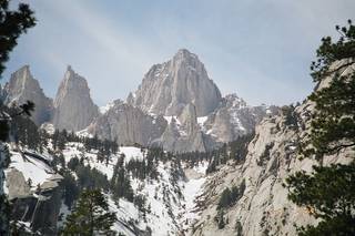
Mount Whitney is in the Sierra Nevada range in California. At an elevation of 14,505 feet above sea level, it is the highest point in the contiguous United States.
Geologically, the mountain went through the typical phases of evolution for high Sierra peaks: uplift as a fault block mountain, erosion, glaciation, and forestation. Mount Whitney is the highest peak because the block's uplift was not uniform: the block was uplifted the most in the southeast corner, where Whitney lies. There still remain some very small residual glaciers in shaded cirques on Whitney, which look nothing more than patches of snow from a distance.
Mount Whitney is the highest point in the lower 48 states, and hence the Sierra Nevada too. However, it may not appear to be the tallest from the floor of Owens Valley because it is not the closest peak to the valley rim, and has many peaks of comparable height surrounding it. Located on the border between Inyo National Forest and Sequoia National Park, the mountain is a popular hiking destination .
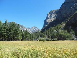
Because Mount Whitney has such vertical relief compared to Owens Valley, ascending from Lone Pine to the summit passes through many different ecological zones. The base is the desert of the Owens Valley floor, transitioning to pine forests as one goes up. The trees end rather abruptly at the treeline. Among the wildlife you will find is the American black bear; grizzlies have been extinct in this area for more than a century. Mosquitoes will be a problem during spring and early summer between the foothills and the treeline, especially in places where water flows slowly, such as the several meadows the trail traverses. These meadows can contain pretty flowers like any other meadow.
Broadly speaking, the climate is that of California in general: relatively warm, dry, summers, and cold, snowy, winters. Temperatures vary highly with both elevation and time; dressing in layers is a good idea. Tropical moisture from the North American Monsoon and even the occasional remnant of a Pacific tropical cyclone often causes thunderstorms in mid-late summer. Snow accumulations are in the feet in winter, again varying with elevation.
Everybody in the Mt. Whitney Zone must possess a valid wilderness permit. This includes BOTH backpackers and day hikers, for which separate types of permits are issued. From May 1 to November 1, entry and exit quotas limit the number of permits that are available. From November 2 to April 30, an unlimited number of permits are available. Permits are issued at the InterAgency Visitor Center, 1 mile south of Lone Pine, CA. Permits for the quota period may be reserved in advance, or obtained on a "walk-in" basis. Most permits for the Mt. Whitney Trail are reserved during the Mt. Whitney lottery in February. The lottery is for Mt. Whitney Trail permits only. Lottery applications can be obtained from the Mt. Whitney lottery web site or by calling (760) 873-2483. The visitors are committed to strict leave no trace practices along the Mt. Whitney trail.
The mountain itself is a sight to see, even from far from the summit. The summit is not, however, visible from much of the trail, due to the trail's route through the canyon of Lone Pine Creek, which is oriented south of the mountain. During periods of significant flow on Lone Pine Creek, the waterfalls on the creek, particularly the one immediately above Whitney Portal, also attract attention; however, they will not impress as much as the waterfalls on the west side of the Sierras, which have larger watersheds and deeper glacial valleys. The summit itself naturally affords wide-sweeping views, but you cannot see as far as you might expect from a mountain of this height, especially to the west. This is because of other nearby mountains; in particular, the Kern Divide limits your view westward into Sequoia National Park to no more than a few miles across the Kern River's valley. The view eastward is somewhat further, although it too is obstructed by the White Mountains. Hence, your view from the summit is best thought of as a sweeping vista of the high Sierras, the highest they get. Look for Guitar Lake on the west flank; its shape is unmistakable. On the summit you will find fulgurites from lightning, the Smithsonian Institute Shelter, a hut built in 1909 for housing scientists. You will also find a large plaque on the ground that certifies Whitney as having an elevation of 14505 feet .
Getting all but distant glances of the mountain necessarily entails hiking or climbing into the backcountry. Hikers intending to summit Whitney must acclimate accordingly due to the massive elevation change involved; the summit of Mount Whitney is about 8000 feet above the floor of Owen Valley where Lone Pine is located. Day hikers will need 10-21 hours to complete the hike, which means starting the hike early in the morning and finishing late at night, especially for slower hikers. This hike should not be attempted without proper preparation, like any hike. There is a guestbook on the wall of the Smithsonian hut on the summit; the hut itself is closed to entry.
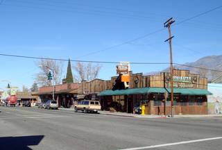
Food, gas and other supplies are available at the base of the Mount Whitney trailhead in the town of Lone Pine. A small general store also seasonally operates at Whitney Portal to serve campers and hikers; the store also sells souvenirs such as t-shirts boasting of having summited the mountain.
The general store at Whitney Portal is the only concession providing food in the area. Elsewhere, all other food must be brought in. Lone Pine, however, has a number of grocery stores and restaurants where more substantial food supplies can be obtained. Bears will attempt to get your food while you are anywhere in the Sierras, so it must be stored accordingly for the safety of both you and them.
As with any backcountry area in the high Sierras, there are many dangers that hikers must beware of. These include but are not limited to:
- Bears: All food must be stored in bear-resistant containers of some kind, whether they be lockers in the Whitney Portal campground, or bear canisters elsewhere; overhead food hangs have been deemed insufficient and are thus no longer allowed in the Sierras. If you are attacked by a bear in this area, you should fight back. Maintain a safe distance from all bears.
- Weather: In the summer, thunderstorms are frequent, and lightning is especially a major hazard above the treeline. Although the hut at the summit was originally designed with lightning protection in mind, it cannot and should not be used as a shelter against this; the fulgurites on the granite near the summit say it all. In the winter, major snowstorms and freezing temperatures present their own dangers, and most hikers hike when there is no snow. Accordingly, check the local weather forecast, bearing in mind that descending to a relatively lightning-safe elevation from the summit can take hours.
- Terrain: The trail is uneven, and when snow is present on the trail, footholds can be slippery. Sturdy shoes and hiking poles are strongly recommended. The trail also has a sizable handful of unbridged stream crossings, some of which can be difficult during peak spring runoff during wet years. When there is much snow remaining on the ground, many of these crossings, especially towards the higher elevations, can be masked by massive banks of snow, which may or may not form stable snow bridges, under which the creeks flow unnoticed. The collapse of these can be hazardous. When approaching Trail Crest, the steep slope the trail traverses can be especially hazardous, particularly when snow covers the trail. In this eroding environment, rockfalls and other mass wasting also present a danger.
- Altitude: The summit of Mount Whitney is more than 6000 feet (1800 m) above the Whitney Portal trailhead and is, after all, the highest point in the lower 48 states. If you are inadequately conditioned, you may find yourself beginning to have trouble breathing past the treeline. Descend immediately if you do not feel like your respiratory capacity is sufficient for making the whole journey. The altitude also causes you to be thirsty; drink and bring plenty of water and other fluids.
See altitude sickness for more detailed advice.
- Water-borne illnesses: All natural water must be purified accordingly. Failure to do so can result in infection from pathogens that are naturally present in the water sources.
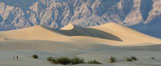
Just 90 miles to the east (and nearly 2.8 miles [4.5 km] down) from the highest point lies the lowest point, in Death Valley. The nearest town is the small town of Lone Pine