
North Norfolk is an Outstanding Area of Natural Beauty (AONB) and district in Norfolk. The area is in East Anglia, a region in the East of England.
- Aylsham.
- Blakeney.
- Burnham Market.
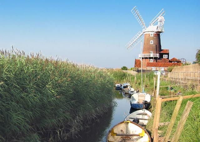
- Cley next the Sea.
- Cromer. - Home of the North Norfolk District Council Offices.
- Fakenham.
- Holt.
- Hunworth.
- Morston.
- Old Hunstanton & Hunstanton.
- Sheringham.
- Wells-next-the-Sea.
Aylsham.
Blakeney.
Burnham Market.
Cley next the Sea.
Cromer. - Home of the North Norfolk District Council Offices.
Fakenham.
Holt.
Hunworth.
Morston.
Old Hunstanton & Hunstanton.
Sheringham.
Wells-next-the-Sea.
A quiet backwater, and largely unspoilt coastal region. The landscape is mostly flat and agricultural populated by quaint, if unremarkable towns and villages. The real highlight is the coastline, which ranges from the sandy beaches of Sheringham and Cromer to the mudflats of Morston marshes.
As for much of East Anglia the region is drier than more western areas. Being a costal area North Norfolk has a narrow temperature range than further inland and in summer can enjoy clloing sea breezes. Detailed information can be found on the UK Met Office Weyborne Climate page or UK Met Office East of England Climate page.
 The A149 is an 85-mile long road from King's Lynn to Great Yarmouth in the Norfolk Broads. From King's Lynn to Cromer the road follows the coastline. To access Cromer from King's Lynn, you can use the A148, passing through West Norfolk, Fakenham and Holt, but the A149 is a scenic route, following the coastline and passing through the small villages of North Norfolk. Not a recommended route for HGVs, tourists can use this road to go to a number of places, including many of the attractions mentioned in this article.
The road passes through the ever-changing, agricultural and coastal landscape of North Norfolk, and don't be surprised about the small narrow sections of road, namely in Stiffkey and Burnham Overy Staithe. Part of National Cycling Route 1 that runs along the North Norfolk Coastline uses the A149, a recommended local cycling route. A public bus service, the Coasthopper.
- Sheringham, follows the route from King's Lynn to Cromer, operating all year round calling at most of the destinations on the Coast Road, including Burnham Market.
From west to east, the road passes through: Hunstanton, Old Hunstanton, Holme-next-the-Sea, Thornham, Titchwell, Brancaster, Brancaster Staithe, Burnham Deepdale, Burnham Norton, (Burnham Market is a few miles inland from here, and well worth a diversion. You can use the B1135 or B1105 to get there), Burnham Overy Staithe, Holkham, Wells-next-the-Sea, Stiffkey, Morston, Blakeney, Cley next the Sea, Salthouse, Weybourne, Kelling, Sheringham, West Runton, East Runton, Cromer.
The local dialect and accent is referred to as Broad Norfolk. The accent comes from Norfolk and is used by some locals. The accent is easy to understand, but there are some Norfolk Slang words that are a little different to the usual English language. As the local dialect developed independently from other dialects, areas of it can seem very different to other parts of East Anglia. See Norfolk#Talk
Take a ferry to see the Common and Grey seals at Blakeney Point.
- Birdwatching at Cley, Blakeney Point, Titchwell and Holme.
- Visit Seal Colony at Blakeney Point.
- Walking
- Walk along the Norfolk Coast Path long distance footpath (84 miles) from Hunstanton past Cromer to Sea Palling.
- Walk the Paston Way (22 miles) from Cromer closely following the coast to Bacton then inland to North Walsham.
- Walk the Weavers' Way long distance footpath (61 miles) from Cromer to Great Yarmouth.
- Walk around Sheringham Park, National Trust property.
Famous for locally caught seafood including Cromer Crabs.
Most towns and villages in the area have pubs & restaurants. In the coastal villages there are often cafes and tea rooms serving traditional tea (or coffee) and cakes.
In case of emergency at sea, dial 999 (or 112) and ask for "Coastguard".
There is a lifeguard service at Cromer, Sheringham, Mundesley and Sea Palling. This operates daily from June until the first week in September, from 10AM to 6PM. The lifeguarded zone is defined by red and yellow flags on the beach, with the beach lifeguard station also flying a red and yellow flag. Do not swim if a red flag is flying.
On occasion live ammunition and unexploded bombs from World War II have been found on the coast. If you do come across a suspicious item leave it alone and report it to the coast guard.
This is a tidal region so be careful, especially with young children.