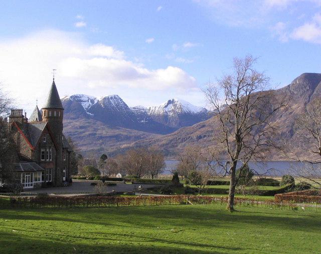
Torridon is an area on the west coast of Ross and Cromarty in the Scottish Highlands. The settlement straggles along the shores of Loch Torridon and takes in Torridon village (also known as Fasaig), Inveralligin and Diabaig to the north of the loch, Annat to the south-east, Shieldaig to the west, and Kinlochewe to the east. It's backed to the north by steep mountains, including several Munros, and the main reason to visit is for hill-walking and climbing.

- The Torridonian mountains have striking scenery. Liathach, Beinn Alligin and Bein Eighe (with a nature reserve) are the best known mountains but don't neglect the smaller ones.
- Deer Museum. Apr-Sept Su-F 10:00-17:00. A small museum run by the National Trust for Scotland, about the life and history of red deer. It has an interesting collection of deer skulls and antlers. There is often a herd of red deer in a nearby field. Free.
- See Gairloch for Inverewe Gardens.
Deer Museum. Apr-Sept Su-F 10:00-17:00. A small museum run by the National Trust for Scotland, about the life and history of red deer. It has an interesting collection of deer skulls and antlers. There is often a herd of red deer in a nearby field. Free.
Walking and climbing are the main reason to come to Torridon. There are several Munros - mountains over 3000 feet / 914 m. The highest are north of Loch Torridon, steep and rocky with some scrambling involved.
- Beinn Alligin. (3235 ft / 986 m) is a curved ridge, including the Horns of Alligin. It's usually climbed from the lane to Inveralligin: there's a car park at the foot of the path.
- Liathach. (3461 ft / 1055 m) is a very steep rocky ridge, and a serious challenge in winter. It's climbed from the A896 in Glen Torridon.
- Beinn Eighe. (3310 ft / 1010 m) is a large complex mountain, with multiple summits, spurs and corries. It can be climbed from Glen Torridon or from Kinlochewe.
- Beinn Dearg. (2999 ft / 913 m) misses out on Munro status by less than a metre, so it is much less climbed than its neighbours. Use the same start point as for Beinn Alligin.
Hills south of the loch are not quite as high, but give great views across the loch to the mountains beyond. The main peaks are Ben Shieldaig, Beinn Damh and Beinn na h-Eaglaise.
Some lower level walks:
- Follow the path along the north side of Loch Torridon, past Inveralligin, Diabaig and around the coast to Craig bothy. This links to the end of the road at Red Point.
- From the Torridon Hotel, old road/track along the south side of Loch Torridon, to Badan Mhugaidh and Balgy.
- The rugged peninsula to the west is Applecross.
Consult walkhighlands.co.uk for detailed hiking suggestions.
- Or hire a rowing boat at Inveralligin and enjoy the views from the water.
Beinn Alligin. (3235 ft / 986 m) is a curved ridge, including the Horns of Alligin. It's usually climbed from the lane to Inveralligin: there's a car park at the foot of the path.
Liathach. (3461 ft / 1055 m) is a very steep rocky ridge, and a serious challenge in winter. It's climbed from the A896 in Glen Torridon.
Beinn Eighe. (3310 ft / 1010 m) is a large complex mountain, with multiple summits, spurs and corries. It can be climbed from Glen Torridon or from Kinlochewe.
Beinn Dearg. (2999 ft / 913 m) misses out on Munro status by less than a metre, so it is much less climbed than its neighbours. Use the same start point as for Beinn Alligin.
Or hire a rowing boat at Inveralligin and enjoy the views from the water.
The village store is well provisioned. It's open M-Sa 10:00-17:00 and has a café.
- Torridon Hotel has fine dining in their 1887 Restaurant, and pub grub at the Inn.
- Torridon Inn: see sleep listing. Limited bar opening in winter.
- The road south winds around Loch Carron to Plockton, Dornie and Kyle of Lochalsh, which brings you to Skye.
- Or go east via Kinlochewe and Loch Maree to Gairloch.
