Fort William is a town in the Scottish Highlands, sitting at the head of Loch Linnhe. With a population of 10,500, it's the main transport, commercial and visitor hub for the area. It's a major centre for outdoor activities, particularly hill-walking on Ben Nevis and skiing on the Nevis Range. The TIC is Fort William iCentre at 15 High St, open daily 09:00-17:00. A couple of miles north of town is a secondary built-up area at the point where Loch Linnhe turns west into Loch Eil, the River Lochy flows out, and the Caledonian Canal begins. Facilities in these villages of Corpach, Bannavie, Caol and Inverlochy are also described on this page.
Loch Linnhe is a fjord, the sea-flooded southwest end of the Great Glen, the long diagonal fault line that slices across the Highlands to Inverness. Inland along the glen are the freshwater lochs of Loch Lochy, Loch Oich and Loch Ness.

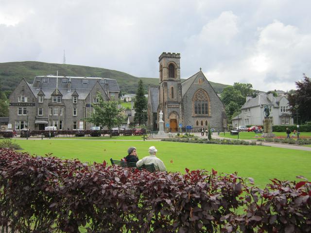
- Pleasant views across Loch Linnhe, the old Fort is just a few courses of masonry in a seaside park. The town centre is Victorian, but has suffered from poor modern planning, with the busy A82 cutting it off from the prom.
- West Highland Museum, Cameron Square, PH33 6AJ (just off High Street. Jan-Apr & Oct-Dec M-Sa 10:00-16:00, May-Sept to 17:00; July Aug also Su 11:00-15:00. Regional history from earliest times through Jacobites and Victorians to the present. Free, but donations requested.
- The Caledonian Canal is a coast-to-coast channel, built by Thomas Telford in the early 19th C, that makes use of the string of lochs and rivers along the Great Glen - it's 60 miles long but only 22 miles are man-made. Commercially and strategically it was obsolete as soon as it was completed in 1822, as shipping had outgrown it, and round-the-coast navigation was much safer since the end of the Napoleonic wars. It fell into disrepair but was rehabilitated for pleasure craft. At the south end, it starts from Loch Linnhe by a short ladder of locks at Corpach near Fort William. A mile east at Banavie is the photogenic Neptune's Staircase, Banavie PH33 7NG. This is a ladder of eight locks, great for photos, but a long afternoon's work to navigate. It then runs to Lock Lochy, to ascend further at Laggan at the other end. (So yes, these could be called the Loch Lochy locks, which, when locked . . . ) Another straight run connects Loch Oich, the highest part of the system. (Higher still, Loch Garry feeds water to the canal via the River Garry, but the river isn't navigable.) From Loch Oich the canal continues north, descending by another ladder of locks into Loch Ness. Loch Ness is the magnificent natural channel at the heart of the canal system. At its north end, canal and River Ness flow down from Dochgarroch Weir towards the sea at Inverness.
- Lochaber Geopark in High St (M-Sa 10:00-16:00) promotes awareness and organises trips and study around the region's weird geology. This played a key role in shaping 19th / 20th C understanding of how the world's landscapes were constructed - it was realised that the Caledonian Mountains once stretched through Svalbard and Greenland into the Appalachians, until sundered by the new Atlantic Ocean. The geopark stretches from Rannoch Moor in the south to Glen Garry in the north, and from Loch Laggan in the east to the Small Isles out west. For instance 20 miles away are the "Roads of Glen Roy": this glen above the Spean valley has three long parallel ledges on the hillside that look man-made. They were in fact cut by ice grinding along the shore of a vanished lake, which lay at different levels during a cold period after the last Ice Age when arctic conditions returned.
- Treasures of the Earth is a geology museum and shop at Corpach PH33 7JL. Collection of crystals, gemstones and fossils. Open daily Nov-Feb 10:00-16:00; Mar-June & Sept Oct to 17:00, July Aug to 18:00, adult £5.
Pleasant views across Loch Linnhe, the old Fort is just a few courses of masonry in a seaside park. The town centre is Victorian, but has suffered from poor modern planning, with the busy A82 cutting it off from the prom.
West Highland Museum, Cameron Square, PH33 6AJ (just off High Street. Jan-Apr & Oct-Dec M-Sa 10:00-16:00, May-Sept to 17:00; July Aug also Su 11:00-15:00. Regional history from earliest times through Jacobites and Victorians to the present. Free, but donations requested.
The Caledonian Canal is a coast-to-coast channel, built by Thomas Telford in the early 19th C, that makes use of the string of lochs and rivers along the Great Glen - it's 60 miles long but only 22 miles are man-made. Commercially and strategically it was obsolete as soon as it was completed in 1822, as shipping had outgrown it, and round-the-coast navigation was much safer since the end of the Napoleonic wars. It fell into disrepair but was rehabilitated for pleasure craft. At the south end, it starts from Loch Linnhe by a short ladder of locks at Corpach near Fort William. A mile east at Banavie is the photogenic Neptune's Staircase, Banavie PH33 7NG. This is a ladder of eight locks, great for photos, but a long afternoon's work to navigate. It then runs to Lock Lochy, to ascend further at Laggan at the other end. (So yes, these could be called the Loch Lochy locks, which, when locked . . . ) Another straight run connects Loch Oich, the highest part of the system. (Higher still, Loch Garry feeds water to the canal via the River Garry, but the river isn't navigable.) From Loch Oich the canal continues north, descending by another ladder of locks into Loch Ness. [[Loch Ness]] is the magnificent natural channel at the heart of the canal system. At its north end, canal and River Ness flow down from Dochgarroch Weir towards the sea at Inverness.
Lochaber Geopark in High St (M-Sa 10:00-16:00) promotes awareness and organises trips and study around the region's weird geology. This played a key role in shaping 19th / 20th C understanding of how the world's landscapes were constructed - it was realised that the Caledonian Mountains once stretched through Svalbard and Greenland into the Appalachians, until sundered by the new Atlantic Ocean. The geopark stretches from Rannoch Moor in the south to Glen Garry in the north, and from Loch Laggan in the east to the Small Isles out west. For instance 20 miles away are the "Roads of Glen Roy": this glen above the Spean valley has three long parallel ledges on the hillside that look man-made. They were in fact cut by ice grinding along the shore of a vanished lake, which lay at different levels during a cold period after the last Ice Age when arctic conditions returned.
Treasures of the Earth is a geology museum and shop at Corpach PH33 7JL. Collection of crystals, gemstones and fossils. Open daily Nov-Feb 10:00-16:00; Mar-June & Sept Oct to 17:00, July Aug to 18:00, adult £5.
- Long-distance hikes: the West Highland Way stretches from Milngavie near Glasgow to Fort William, and the Great Glen Way continues north to Inverness. They're usually done in stages in that direction, south to north, so the sun and the weather are on your back. But invest in good maps and plan your own itinerary.

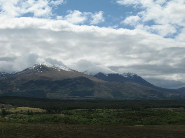
- Climb Ben Nevis, Britain's highest mountain at 1345 m / 4413 feet. This is no small task as you start from almost sea level. The usual route is the "Mountain Track", starting from the visitor centre in Glen Nevis: this is an arduous slog and scramble in good weather, and in winter it demands technical mountaineering skills. Other routes such as the "CMD Arete" are even more testing.
- For less touristy mountains, the Mamores are the ridge above Glen Nevis, west and south of the river. They're opposite Ben Nevis so there's better views of it than on the Track itself. The Mamores are crossed by the most northerly section of the West Highland Way, a 15-mile hike from Kinlochleven.
- Ski & snowboard at Nevis Range. Usually late Dec-April. Nevis Range ski resort is on Aonach Mor, the mountain just north of Ben Nevis. From the car park (£3 per day) take the gondola to "Snowgoose" at 650 m. Chairlifts and tows lead to the summit plateau around 1221 m, with most pistes along this stretch. Just east are some hairy steep descents. Mountain & skiing conditions are highly variable, always check ahead on the resort website. Adult lift pass £36, child or senior £24.
- The Nevis Range gondola runs year round (adult £20, child or senior £11) and is the access to other activities. It has six-seater enclosed cabins, dogs welcome but must be leashed on the mountain. Three easy hill walks loop from the Snowgoose station. Climbers ascending Ben Nevis by the North Face route often start by riding up the gondola. There are cross country and downhill mountain bike courses, and the UCI mountain bike World Cup is often held here. The next event is 1-2 June 2019, tickets now on sale.
- If Nevis Range skiing is unavailable for any reason, check out conditions at Glencoe ski centre, 20 miles south.

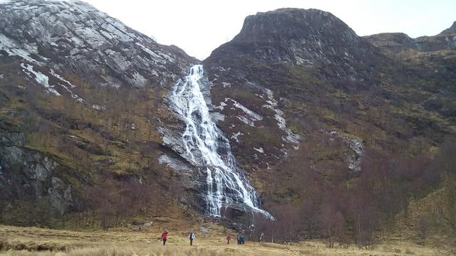
- Glen Nevis is worth exploring in its own right, and not just as an access point for Ben Nevis, or as a fallback if you called off a climb. Drive up the south-bank road past the visitor centre and youth hostel to the Lower Falls (bus N42 comes this far in summer) and onward to the final car park "Nevis Gorge" (free). A trail leads up the gorge to the cable bridge, if you dare teeter across, and the Steall Falls. It's a two hours walk to the waterfall, a 120 m three-tiered cascade. An alternative route up Ben Nevis branches north from here, and trails south into the Mamores.
- The Jacobite steam train runs April-Oct between Fort William and Mallaig. It's a six-hour excursion (depart 10:15, return by 16:00) staying two hours in Mallaig, adult day trip £38 standard, £60 first class, child £21 / £33. Mid-May to mid-Sept there's also an afternoon train (14:30 - 20:30), so you could have six hours in Mallaig, time for a boat trip to the Small Isles, by going in the morning and returning on the afternoon excursion. Trains also stop at Glenfinnan for the obligatory photo of the viaduct, and by request at Arisaig. The morning excursion connects with the Caledonian Sleeper from London. In previous years some of them started from Glasgow or Edinburgh, but they're don't do so in 2019.
- Three Wise Monkeys Climbing Wall, Fassifern Road PH33 6QX. M-F 10:00-22:00, Sa Su 10:00-20:00. Indoor climbing (roped) and bouldering (unroped) walls in an old church. Bouldering £9, try-climbs £20 with kit.
Long-distance hikes: the [[West Highland Way]] stretches from Milngavie near Glasgow to Fort William, and the [[Great Glen Way]] continues north to Inverness. They're usually done in stages in that direction, south to north, so the sun and the weather are on your back. But invest in good maps and plan your own itinerary.
Climb [[Ben Nevis]], Britain's highest mountain at 1345 m / 4413 feet. This is no small task as you start from almost sea level. The usual route is the "Mountain Track", starting from the visitor centre in Glen Nevis: this is an arduous slog and scramble in good weather, and in winter it demands technical mountaineering skills. Other routes such as the "CMD Arete" are even more testing.
For less touristy mountains, the Mamores are the ridge above Glen Nevis, west and south of the river. They're opposite Ben Nevis so there's better views of it than on the Track itself. The Mamores are crossed by the most northerly section of the West Highland Way, a 15-mile hike from Kinlochleven.
Ski & snowboard at Nevis Range. Usually late Dec-April. Nevis Range ski resort is on Aonach Mor, the mountain just north of Ben Nevis. From the car park (£3 per day) take the gondola to "Snowgoose" at 650 m. Chairlifts and tows lead to the summit plateau around 1221 m, with most pistes along this stretch. Just east are some hairy steep descents. Mountain & skiing conditions are highly variable, always check ahead on the resort website. Adult lift pass £36, child or senior £24.
[[Ben Nevis#Glen Nevis | Glen Nevis]] is worth exploring in its own right, and not just as an access point for Ben Nevis, or as a fallback if you called off a climb. Drive up the south-bank road past the visitor centre and youth hostel to the Lower Falls (bus N42 comes this far in summer) and onward to the final car park "Nevis Gorge" (free). A trail leads up the gorge to the cable bridge, if you dare teeter across, and the Steall Falls. It's a two hours walk to the waterfall, a 120 m three-tiered cascade. An alternative route up Ben Nevis branches north from here, and trails south into the Mamores.
The Jacobite steam train runs April-Oct between Fort William and Mallaig. It's a six-hour excursion (depart 10:15, return by 16:00) staying two hours in Mallaig, adult day trip £38 standard, £60 first class, child £21 / £33. Mid-May to mid-Sept there's also an afternoon train (14:30 - 20:30), so you could have six hours in Mallaig, time for a boat trip to the [[Small Isles]], by going in the morning and returning on the afternoon excursion. Trains also stop at [[Glenfinnan]] for the obligatory photo of the viaduct, and by request at [[Arisaig]]. The morning excursion connects with the Caledonian Sleeper from London. In previous years some of them started from Glasgow or Edinburgh, but they're don't do so in 2019.
Three Wise Monkeys Climbing Wall, Fassifern Road PH33 6QX. M-F 10:00-22:00, Sa Su 10:00-20:00. Indoor climbing (roped) and bouldering (unroped) walls in an old church. Bouldering £9, try-climbs £20 with kit.
Plenty of touristy-trappy shops along High Street, regaling the coach parties with Scottish dresses, knitware, souvenirs and whisky. They can offer nick-nacks in just about any clan tartan you've heard of, and probably a few that that you haven't.
There's a string of cheap and cheerful eating places along the length of High Street, mostly open every day; there's no standout.
For self-catering, the main supermarket is Morrisons behind the railway station. Behind the Morrisons there is also a Lidl. There's also a Tesco Metro on High Street and a Spar on Grange Rd at the south end of town.
-iERMT.medium.jpg)
Several pubs along High Street (but no public drinking allowed on the street).
- The Volunteer Arms, 47 High Street PH33 6DH. Daily 12:00-01:00. A good laugh, decent beer, and well-priced spirits. Live sports, dance floor, a good place to warm up before heading to the clubs.
- Grog & Gruel at 66 High St has a wide selection of real ales. Open daily 12:00-00:00.
- The Great Glen, 104 High Street. Daily 07:00-00:00. JD Wetherspoon's pub, with cheap beer and reasonably priced meals.
- Ben Nevis Distillery produces single malt whisky at Lochy Bridge (junction of A82 and A830). Open M-F 09:00-17:00, Sa 10:00-16:00, tours £5.
The Volunteer Arms, 47 High Street PH33 6DH. Daily 12:00-01:00. A good laugh, decent beer, and well-priced spirits. Live sports, dance floor, a good place to warm up before heading to the clubs.
Grog & Gruel at 66 High St has a wide selection of real ales. Open daily 12:00-00:00.
The Great Glen, 104 High Street. Daily 07:00-00:00. JD Wetherspoon's pub, with cheap beer and reasonably priced meals.
Ben Nevis Distillery produces single malt whisky at Lochy Bridge (junction of A82 and A830). Open M-F 09:00-17:00, Sa 10:00-16:00, tours £5.
There is free Internet access in the library on the High Street.
- Fort William is the northern end of the 96-mile West Highland Way footpath from Milngavie north of Glasgow. Clearly, having just arrived, you'll be impatient to do two things: i) ascend Britain's highest mountain, Ben Nevis; and ii) set off on another long-distance hike, the 78-mile Great Glen Way to Inverness. Fortunately both these needs have been thoughtfully catered for.
- The scenic Road to the Isles (A830) runs west from Fort William via Glenfinnan and Arisaig to Mallaig, where ferries ply to Armadale on Skye and to the Small Isles. You can also use this route to reach the Ardnamurchan peninsula via Moidart.
- However the usual route to Ardnamurchan is by the short car ferry crossing at Corran. Routes on the peninsula converge on Strontian. There's also a ferry for foot passengers and bicycles from Fort William town centre to Camusnagaul, connecting with buses on the other side.
- Follow A82 north along Loch Ness, via Fort Augustus and Urquhart Castle near Drumnadrochit, to reach Inverness.
- The road south to Glasgow runs through Glencoe with stunning views, louring mountains, and a ski centre.
